
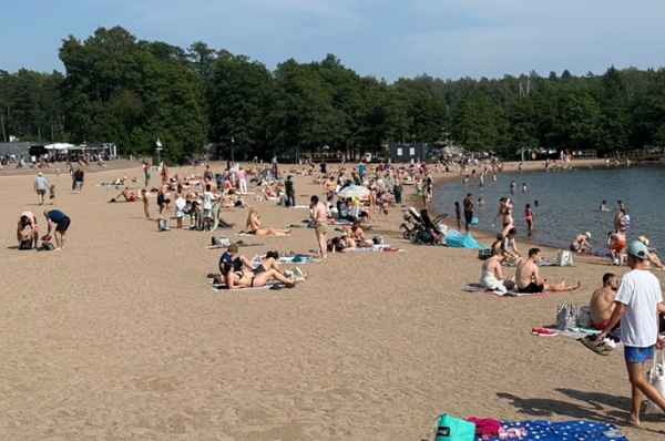

July was unusually warm in many places throughout the country, and exceptionally warm in some places in the central part of the country, according to the statistics of the Finnish Meteorological Institute (FMI).
The average monthly temperature in the northern part of the country was between 14°C and 19°C, while in other parts of the country, the average temperature was between 18°C and 21°C.
The deviation of the average temperature from the usual was widely between 2 and 3 degrees, while it was between 1 and 2 degrees around Inari and Utsjoki.
The highest temperature in July was 32.6°C, which was recorded at Oulu Airport on 31 July.
The lowest temperature was minus 1.3°C, recorded in the village centre of Salla on 6 July.
The first half of the month was slightly cooler for the time of the year than usual but on 11 July, a heatwave began that continued until the end of the month.
Temperatures exceeding 25°C were recorded at the Meltosjärvi observation station in Ylitornio throughout this period, and the 21-day heatwave at the observation station is the longest in Lapland from 1961 onwards.
A large proportion of observation stations in the southern and central parts of the country recorded a 20-day heatwave starting from 12 July. Altogether there were 23 hot days in July, when the highest temperature of the day exceeded 25°C somewhere in Finland. This is seven days more than the July average.
In addition, on each day from 12 July onwards, the highest temperature in the whole country was over 30°C. Consequently, a total of 20 days with temperatures above 30°C were seen in July.
From 1961 onwards, this is the longest period with temperatures above 30°C in Finland; the previous record for hot weather above 30°C in the measurement history was a 13-day heatwave in 1972.
"As climate change progresses, periods of exceptionally sweltering heat will strengthen. They will be more frequent, harsher and will last longer. Heat warnings and preparedness for hot weather are aimed at reducing the harmful health effects especially among the older population and other groups vulnerable to hot weather", said Heikki Tuomenvirta, Head of Group at the FMI.
There was a great deal of variation in the precipitation levels in July: in the southern and western parts of the country, precipitation levels were usual or higher than usual.
On the other hand, rainfall in the strip extending from Pirkanmaa to Kainuu was lower than usual, even unusually or exceptionally low in some places. There was also a great deal of regional variation in Lapland: in many places, the average precipitation levels were not reached, while precipitation around Inari was higher than usual.
The most precipitation during the month, 129.2 mm, was measured at the Kontiojärvi observation station at Raja-Jooseppi in Inari.
The least precipitation, 12.5 mm, was recorded in Kaakkuri, Tornio. The greatest amount of precipitation observed in a single day was 62 mm, measured in Laukansaari, Savonlinna, on 8 July.
Storm Ulla, which arrived in Finland on 3 July, was an unusually strong summer storm that brought strong winds and rainfall. The storm lasted long: there were gusty winds for up to 6–12 hours in a large part of the country.
July was sunnier than usual in nearly all of the country. In the whole country, approximately 280–420 hours of sunshine were recorded at observation stations.
Approximately 48,200 cloud-to-ground lightnings were observed in July, which was slightly below the average for the period 1991–2020 (54,300).
Most of the days with thunderstorms in July occurred in Lapland, except for the last few days of the month.
So far, the number of lightning strikes for the entire year is only slightly higher than the number of lightning strikes for July; very few thunderstorms were recorded in May/June because of the fairly cool weather.
Source: www.dailyfinland.fi